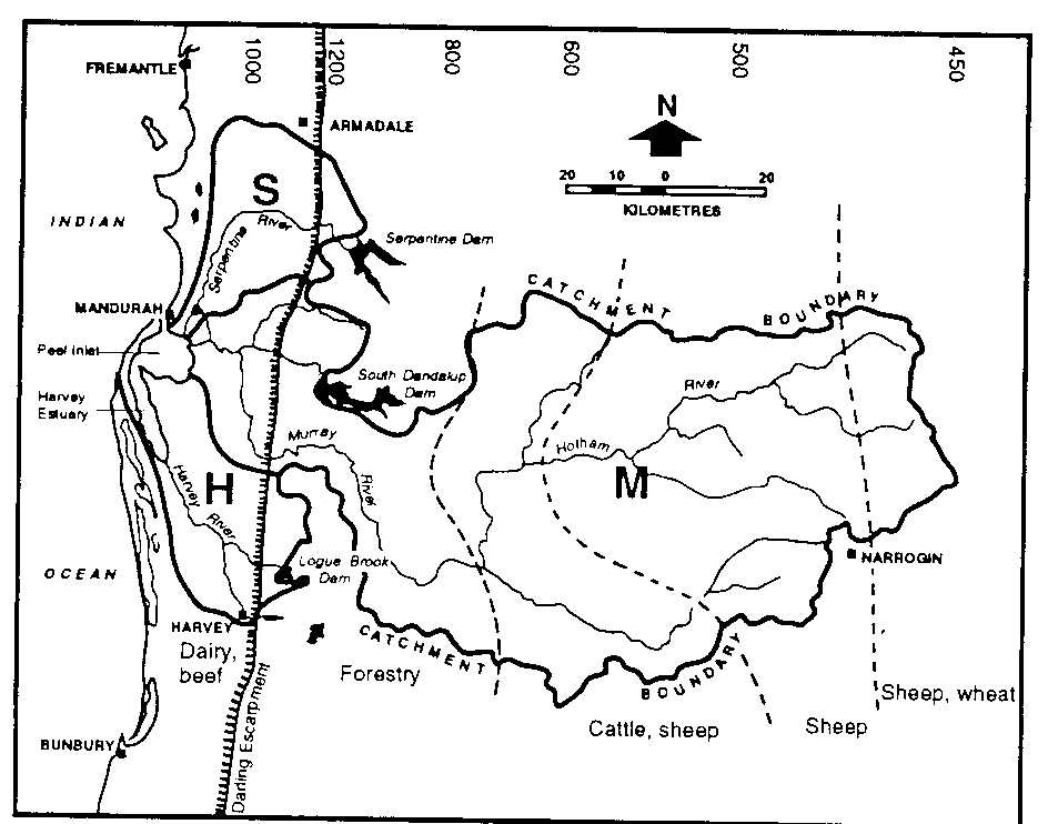
Figure 2. The three catchments of the Peel-Harvey estuarine system, showing rainfall and major land uses. Note the north-south oriented Darling Escarpment (shaded line), which separates the sandy, coastal-plain soils from the largely lateritic uplands. The figures above, and the broken lines, indicate rainfall (mm year'). (Redrawn from McComb and Humphries.9)