Figure 2.13
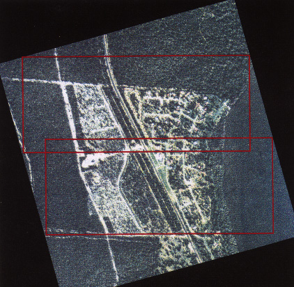
Air photograph raster image after georeferencing and resampling showing
image portions of null data (in black) as a result of flight lines other
than north/south or east/west. Red rectangles represent areas of subset
images excluding the null file values.